| Distance: | No data |
| Minimum elevation: | No data |
| Maximum elevation: | No data |
| Elevation gain (~): | No data |
| Elevation loss (~): | No data |
| Duration: | No data |
Starting from the center of Tramin, the route follows Julius-von-Payer Street and Zallinger Street, leading to the Etschtal cycle path. After crossing the Etsch Bridge in Neumarkt, the route continues along the left side of the river towards Auer. Just before Auer, a sharp right turn marks the entrance to the old Fleimstal railway line. Here begins a steady climb on gravel paths through the Castelfeder nature reserve. Be cautious, as sheep may cross the path!
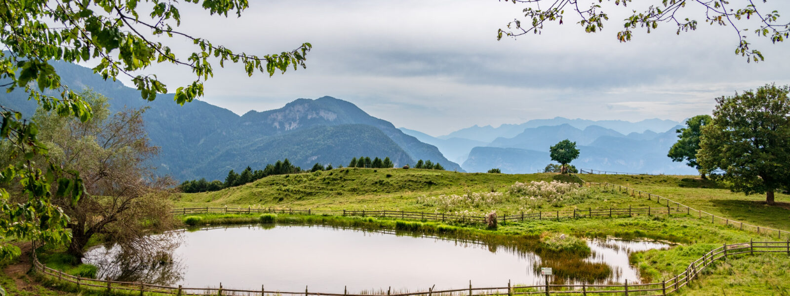
The route continues towards Pinzon and then Montan, mostly following the old railway line, passing through viaducts and short tunnels, until Kaltenbrunn. From here, the route continues on asphalt towards Truden, where there are a few short but steep climbs. From Truden, the route continues on a gravel road to the Cisloner Alm, a perfect spot for a break and to enjoy the panorama.
The return follows the same route back to Truden. From Truden, the route descends on asphalt through the “Mühlen” area, passing under a large viaduct until Pinzon. From there, the route joins the Etschtal cycle path again, crossing the Etsch Bridge in Neumarkt and returning to Tramin.
Route type: Asphalt, gravel, forest roads
Tip: Although the route has some elevation gain, the old railway line does not have steep climbs. Only the section between Truden and Cisloner Alm requires good physical condition due to some short but intense ascents. Be sure to take a break at the Cisloner Alm and enjoy the view!
| Distance: | No data |
| Minimum elevation: | No data |
| Maximum elevation: | No data |
| Elevation gain (~): | No data |
| Elevation loss (~): | No data |
| Duration: | No data |
Accommodation in Tramin
Ads
Available accommodation
 Gartenheim. Quiet, central, breakfast under vines, pool & gar...
 Hotel Pernhof. Suites & Apartments, restaurant, sauna
 Goldene Traube, Panorama & Überbacherhof. B&B, apart., re...
 Rebenheim. New rooms and new breakfast room
 Urbanhof. Quiet place with pool.
 Vineus. New! Appartments, suites and rooms