| Distance: | No data |
| Minimum elevation: | No data |
| Maximum elevation: | No data |
| Elevation gain (~): | No data |
| Elevation loss (~): | No data |
| Duration: | No data |
Tour description:
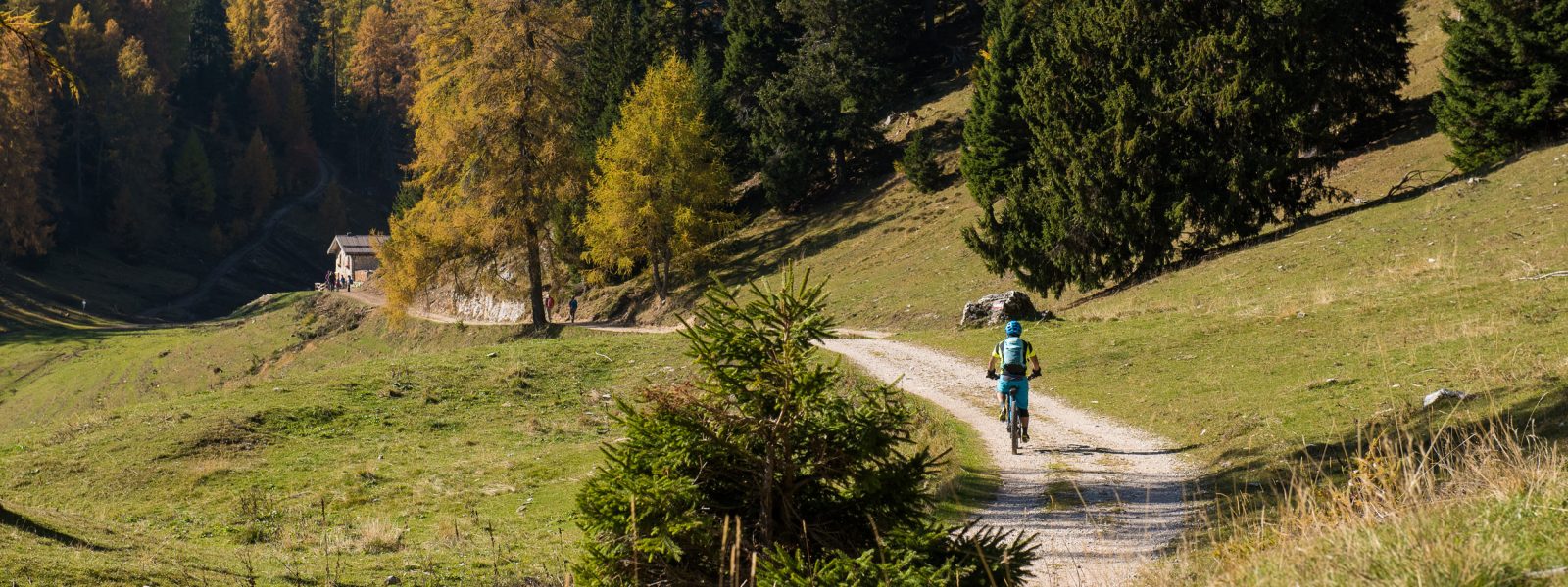
This extensive high-altitude tour starts in Tramin and takes you through Kaltern to the lower station of the Mendelbahn. From there, the historic cogwheel railway carries you comfortably up to the Mendel Pass (1,363 m), where the real biking adventure begins – offering breathtaking views, varied trails, and a scenic climb to the Überetscher Hütte.
From the mountain station, the route initially descends gently along forest tracks and gravel paths, before a steady ascent to the Überetscher Hütte begins. Over the course of roughly 900 meters of elevation gain, you’ll ride along quiet roads and wide gravel tracks. The climb is consistently moderate, making it ideal for e-MTBs as well.
At 1,773 m, you reach the Überetscher Hütte, a popular stop with spectacular views over the surrounding Dolomites and the Adige Valley. It’s the perfect place to pause, take in the scenery, and enjoy a well-earned break.
The return follows the same route back to the Mendel Pass, where the Mendelbahn brings you down to Kaltern. From there, you can ride back to Tramin the same way as the outward route, or choose a scenic alternative via Mitterdorf, Söll, or along the South Tyrolean Wine Road.
Recommended equipment:
It is recommended to use an e-MTB or an MTB with appropriate gearing for longer climbs. A helmet is required, and it is strongly advised to bring gloves as well as sun and rain protection. It is important to carry 1.5–2 litres of water, although food and drinks are available at the Überetscher Hütte and at the Romeno Alm. Don’t forget your guest card!
Highlights and tips:
Tour summary:
Distance: 51 km
Elevation gain: approx. 1.571 m
Difficulty: difficult (due to length and elevation)
Duration: approx. 5–6 hours including breaks
Riding skill level: easy (asphalt & forest roads, no technical trails)
| Distance: | No data |
| Minimum elevation: | No data |
| Maximum elevation: | No data |
| Elevation gain (~): | No data |
| Elevation loss (~): | No data |
| Duration: | No data |
 Hotel Pernhof. Suites & Apartments, restaurant, sauna
 Goldene Traube, Panorama & Überbacherhof. B&B, apart., re...
 Söllerhof. Modern appartments. Large terrace in the vines
 Vineus. New! Appartments, suites and rooms